


LITTLE BEAVER TWP Voting District, Lawrence County, Pennsylvania
About
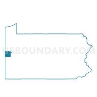
Outline

Summary
| Unique Area Identifier | 660488 |
| Name | LITTLE BEAVER TWP Voting District |
| County | Lawrence County |
| State | Pennsylvania |
| Area (square miles) | 20.50 |
| Land Area (square miles) | 20.37 |
| Water Area (square miles) | 0.13 |
| % of Land Area | 99.35 |
| % of Water Area | 0.65 |
| Latitude of the Internal Point | 40.87403450 |
| Longtitude of the Internal Point | -80.46584320 |
Maps


Graphs
Select a template below for downloading or customizing gragh for LITTLE BEAVER TWP Voting District, Lawrence County, Pennsylvania


Neighbors
Neighoring Voting District (by Name) Neighboring Voting District on the Map
- BIG BEAVER Voting District, Beaver County, PA
- DARLINGTON TWP Voting District, Beaver County, PA
- ENON VALLEY Voting District, Lawrence County, PA
- NEW BEAVER Voting District, Lawrence County, PA
- NORTH BEAVER TWP VTD 02, Lawrence County, PA
- NORTH BEAVER TWP VTD 04, Lawrence County, PA
- PRECINCT SPT 2, Mahoning County, OH
- Voting District UNITY TWP NORTH, Columbiana County, OH
Top 10 Neighboring County Subdivision (by Population) Neighboring County Subdivision on the Map
- Unity township, Columbiana County, OH (9,957)
- Springfield township, Mahoning County, OH (6,703)
- North Beaver township, Lawrence County, PA (4,121)
- Big Beaver borough, Beaver County, PA (1,970)
- Darlington township, Beaver County, PA (1,962)
- New Beaver borough, Lawrence County, PA (1,502)
- Little Beaver township, Lawrence County, PA (1,411)
- Enon Valley borough, Lawrence County, PA (306)
Top 10 Neighboring Place (by Population) Neighboring Place on the Map
Top 10 Neighboring Unified School District (by Population) Neighboring Unified School District on the Map
- Blackhawk School District, PA (17,762)
- Big Beaver Falls Area School District, PA (13,827)
- Mohawk Area School District, PA (10,867)
- East Palestine City School District, OH (8,285)
- Springfield Local School District, OH (8,245)
Top 10 Neighboring State Legislative District Lower Chamber (by Population) Neighboring State Legislative District Lower Chamber on the Map
- State House District 61, OH (116,012)
- State House District 1, OH (107,841)
- State House District 10, PA (58,463)
- State House District 9, PA (56,261)
- State House District 14, PA (55,975)
Top 10 Neighboring State Legislative District Upper Chamber (by Population) Neighboring State Legislative District Upper Chamber on the Map
- State Senate District 30, OH (338,710)
- State Senate District 33, OH (323,425)
- State Senate District 47, PA (225,797)
Top 10 Neighboring 111th Congressional District (by Population) Neighboring 111th Congressional District on the Map
Top 10 Neighboring Census Tract (by Population) Neighboring Census Tract on the Map
- Census Tract 8136, Mahoning County, OH (8,324)
- Census Tract 9501, Columbiana County, OH (5,712)
- Census Tract 113, Lawrence County, PA (4,487)
- Census Tract 6053, Beaver County, PA (3,220)
- Census Tract 114, Lawrence County, PA (2,219)
- Census Tract 6006.01, Beaver County, PA (2,216)